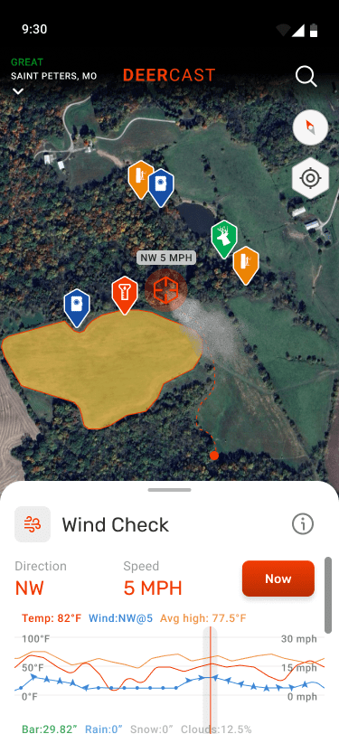
Wind Check
Play the wind and understand how it behaves with Wind Check. This tool allows you to see the current and future winds out to five days on your map, paired with crucial information for how to hunt that particular windspeed.
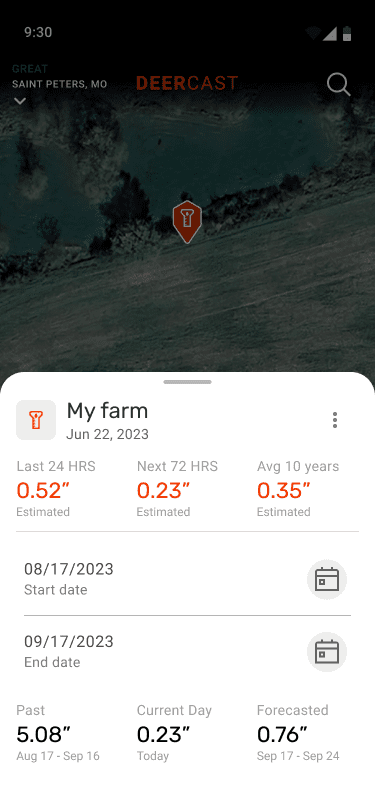
Rain Stations
Deer health, food plots, mast crops, all depend on precipitation. Know historical rainfall and what's coming by placing DeerCast Rain Stations wherever you choose.
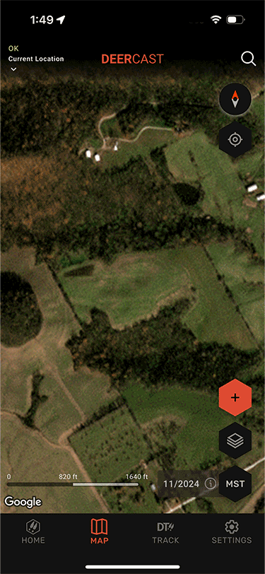
Monthly Satellite Maps
Hunting landscapes change fast—clearcuts, burns, floods, food plot activity, and agriculture can reshape habitats in a season. Get monthly updated maps to help plan your hunts.
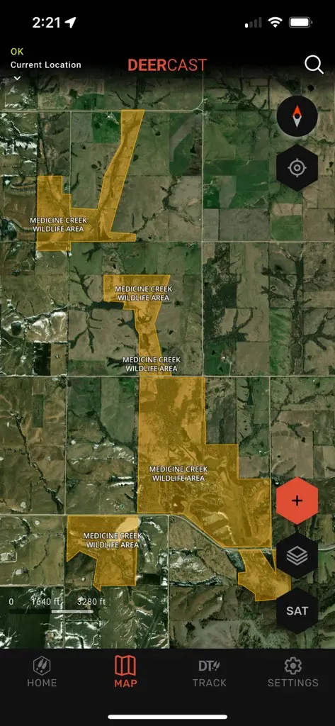
Public Land Layer
DeerCast’s public land layer unlocks a better understanding of where public hunting boundaries are, and discovering new access points gets you away from the crowd.
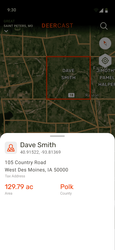
Parcel Data
Gain access to new ground and know who owns the land around you with basic parcel data. You'll see property & plat lines along with owner name, tax address, county, and acreage all sourced from county records.
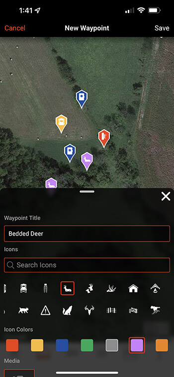
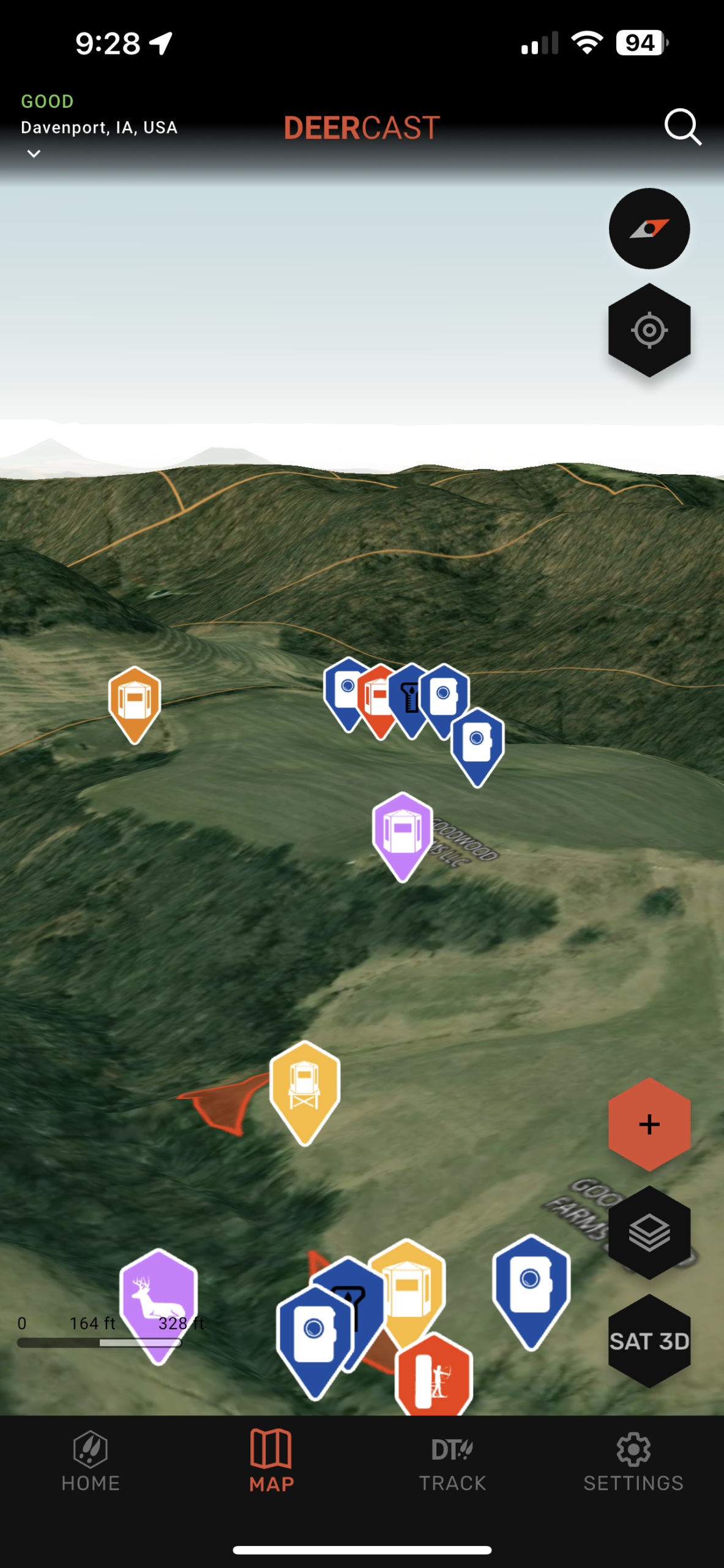
Waypoints
Choose from a concise library of purpose-built waypoints that hunters need.
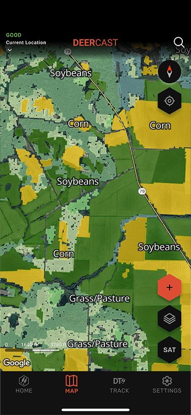
Crop History Layer
Locate areas with top food sources for whitetails. Browse annual crop data across the continental United States showcasing 134 different crops at a granular level.
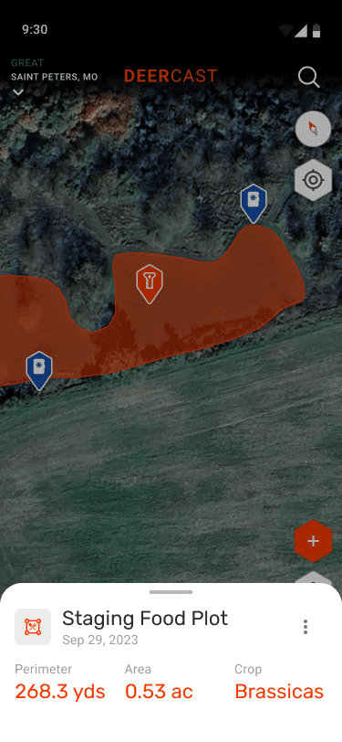
Plot/Area Measurement
Use the Food Plot tool to know the exact acreage to help you calculate the amount of seed, fertilizer, and chemicals for your plots. Area Measurement allows you to determine the perimeter and surface area of any given space.
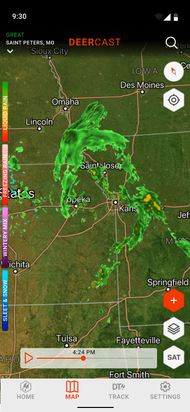
Live Radar
Get real-time and forecasted doppler radar animated into your maps, helping you time your planting, your hunts, and what gear to pack.
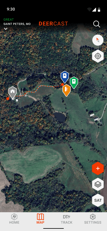
Path Tracker
On a blood trail, shed hunting, sharing access to a stand, or ensuring you've fully covered your food plot with fertilizer or seed, Path Tracker creates a GPS track you can save to reference or share later.
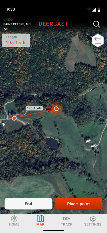
Distance Measurement
Check the yardage on your shot. Determine the distance of your walk to the stand. Whether it's yards or miles, the Measurement tool in DeerCast supercharges your Maps with a built-in rangefinder!
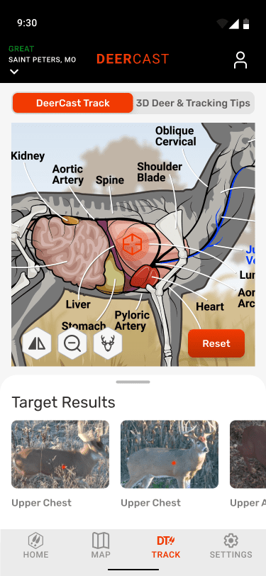
3D Mapping
Scout your property from a new perspective with DeerCast 3D Maps. Analyze bedding areas, travel routes, and funnels using fully interactive maps that let you rotate, tilt, and explore every angle. Even subtle terrain changes become clear.